Mapping of groundwater zones in deserts in ArcGIS with AHP

Why take this course?
Course Title: Mapping of Groundwater Zones in Deserts with ArcGIS and AHP
Course Instructor: GIS Lab
Headline: Step-by-Step Guide to Delineating Groundwater Areas in Desert Zones Using GIS and AHP
📘 Course Description:
This practical online course is designed for students who are eager to harness the power of Geographic Information Systems (GIS) combined with the Analytical Hierarchy Process (AHP) to identify and map groundwater zones in desert regions. 🌡️🏜️
Why this course?
- Accessible: Easy to understand, even for beginners in GIS or AHP.
- Versatile: Applicable to a wide range of study areas and research projects.
- Comprehensive: Covering everything from the basics of groundwater in deserts to advanced GIS mapping techniques with AHP.
🕊️ Understanding Groundwater: Groundwater is Earth's largest reservoir of fresh water, quietly nestled in aquifers beneath our feet. In desert zones, this precious resource can often be found seeping into oases or bubbling up as springs. It's a crucial resource for sustainable development and human survival. 💧🏞️
📋 Course Content:
- Introduction to Groundwater in Deserts: An overview of the importance, movement, and presence of groundwater in arid environments.
- GIS Basics for Water Resources: Understanding the fundamentals of GIS and its application in hydrology and environmental studies.
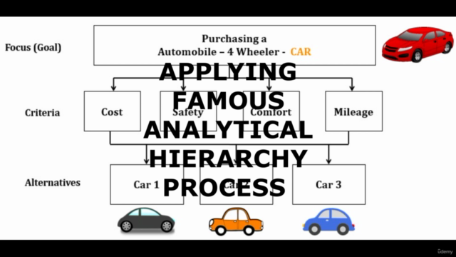
- AHP Explained: A detailed exploration of AHP as a decision-making tool within GIS, and how it can be applied to various scenarios including soil erosion modeling. 📊
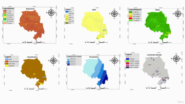
- Thematic Layers for Groundwater Mapping: An in-depth look at the six key thematic layers that influence groundwater distribution:
- Climate patterns
- Land topography
- Geological formations
- Vegetation and land cover types
- Human impacts on water retention
- Lineament analysis
- Preparing Data for Analysis: Learn how to collect, process, and analyze spatial data related to each thematic layer. 🛠️
- Applying AHP Weights: Techniques for assigning appropriate weights to the thematic layers in the GIS model.
- Creating Groundwater Maps: Step-by-step guidance on delineating groundwater zones using the prepared thematic layers and AHP analysis. 🌍
- Real-World Application: Translate your new skills into practical outcomes, suitable for research papers, dissertations, or further exploration in hydrogeology.
🎓 Learning Outcomes: By completing this course, you will:
- Understand the fundamental principles of groundwater in desert environments.
- Gain proficiency in using ArcGIS for mapping groundwater zones.
- Master the application of AHP for weight assignment and decision analysis in GIS.
- Be equipped to conduct independent research or contribute to significant projects on water resources.
📅 Enroll Now! Join us on this journey to uncover the hidden treasures beneath the sands – groundwater in desert zones. Whether you're a student, researcher, or environmental enthusiast, this course will provide you with the tools and knowledge to make a real-world impact. 🌍💧🛠️
Enroll today and take your first step towards becoming an expert in mapping groundwater zones using GIS and AHP! 🎉📚🌫️
Course Gallery


Loading charts...