Google Earth Engine for Remote Sensing & GIS: 3 courses in 1

Why take this course?
🌏 Google Earth Engine for Remote Sensing & GIS: Master the Geospatial Universe 🚀
Course Headline: 🚀 Embark on a Journey to Master Geospatial Analysis with Google Earth Engine
Course Overview:
Get ready to unlock the full potential of geospatial analysis and Remote Sensing through the power of Google Earth Engine (GEE). This all-in-one course is meticulously designed for both beginners and seasoned professionals who aim to become adept in handling vast spatial data with ease. 🌍🛰️
What You Will Achieve:
By completing this course, you will:
- Gain a solid understanding of the Earth Engine platform.
- Master the basics of image analysis and how to apply them effectively.
- Learn JavaScript essentials tailored for spatial analysis in cloud environments.
- Discover how to import and export data seamlessly within Earth Engine.
- Perform complex arithmetical calculations on geospatial datasets.
- Conduct iterations and map functions over image collections.
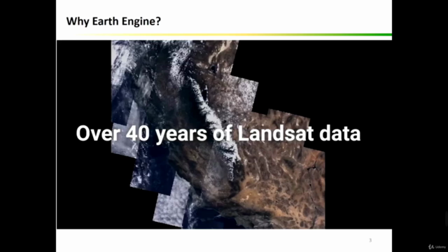
- Apply pre-processing techniques to Sentinel and Landsat data for real-world applications such as drought monitoring, flood mapping, and land cover classification using advanced algorithms like Random Forest. 🌱🏗️🍃
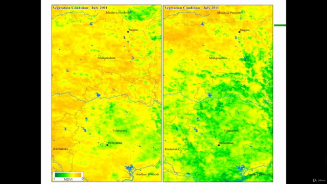
- Explore time series trend analysis capabilities within Google Earth Engine.
Course Structure:
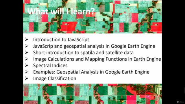
- Introduction to the Earth Engine Platform: Laying the foundation for understanding what GEE is and how it can transform your spatial data analysis.
- Fundamentals of Image Analysis: Diving into the core concepts that are critical for working with remote sensing imagery.
- JavaScript Basics for Spatial Analysis: Learning JavaScript as it applies to spatial data analysis, focusing on the tools and techniques you'll need.
- Data Import/Export: Understanding how to effectively manage your data within Earth Engine.
- Arithmetical Image Calculations: Mastering the art of performing precise calculations on geospatial data.
- Advanced Image Collections Analysis: Learning to apply functions and perform iterations over large image collections with confidence.
- Real-World Applications: Applying pre-processing techniques and machine learning algorithms for practical outcomes like monitoring deforestation or mapping urban expansion.
- Time Series Analysis: Introducing the concept of time series data in GEE and how to analyze trends over time.
Hands-On Learning Experience:
This course is not just theoretical; it's packed with hands-on practical exercises that will solidify your learning. You'll receive step-by-step instructions, code samples, and datasets to apply what you've learned in real-world contexts. 🛠️💻
Included Resources:
Upon enrolling, you will gain access to all the data used throughout the course, JavaScript code files, and future resources to support your continued geospatial analysis endeavors.
Why Enroll Today?
- Start from Scratch or Sharpen Your Skills: Whether you're a beginner or looking to expand your expertise, this course is tailored for you.
- Practical Exercises and Real-World Applications: Engage with practical exercises that mirror real-world challenges.
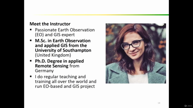
- Learn from an Industry Leader: Kate Alison, the course instructor, brings a wealth of knowledge and experience to the table.
- Community of Learners: Join a community of like-minded individuals who are passionate about geospatial analysis and remote sensing.
Your Pathway to Geospatial Mastery:
Embark on your journey to become an expert in geospatial analysis with Google Earth Engine today! Enroll now and unlock the door to new opportunities and a deeper understanding of spatial data analysis. 🌟🌍
Ready to dive into the world of Remote Sensing and GIS with Google Earth Engine? Click 'Enroll' and take your first step towards becoming an expert in geospatial analysis! 🎉📊
Course Gallery
Loading charts...